| 詳細情報表示 | 1件の内1件目を表示中 |
| 新規検索 |
| サムネイル一覧 | 簡易情報付一覧 | ArtWiki |
| No. cortazzi019 Nickname. |
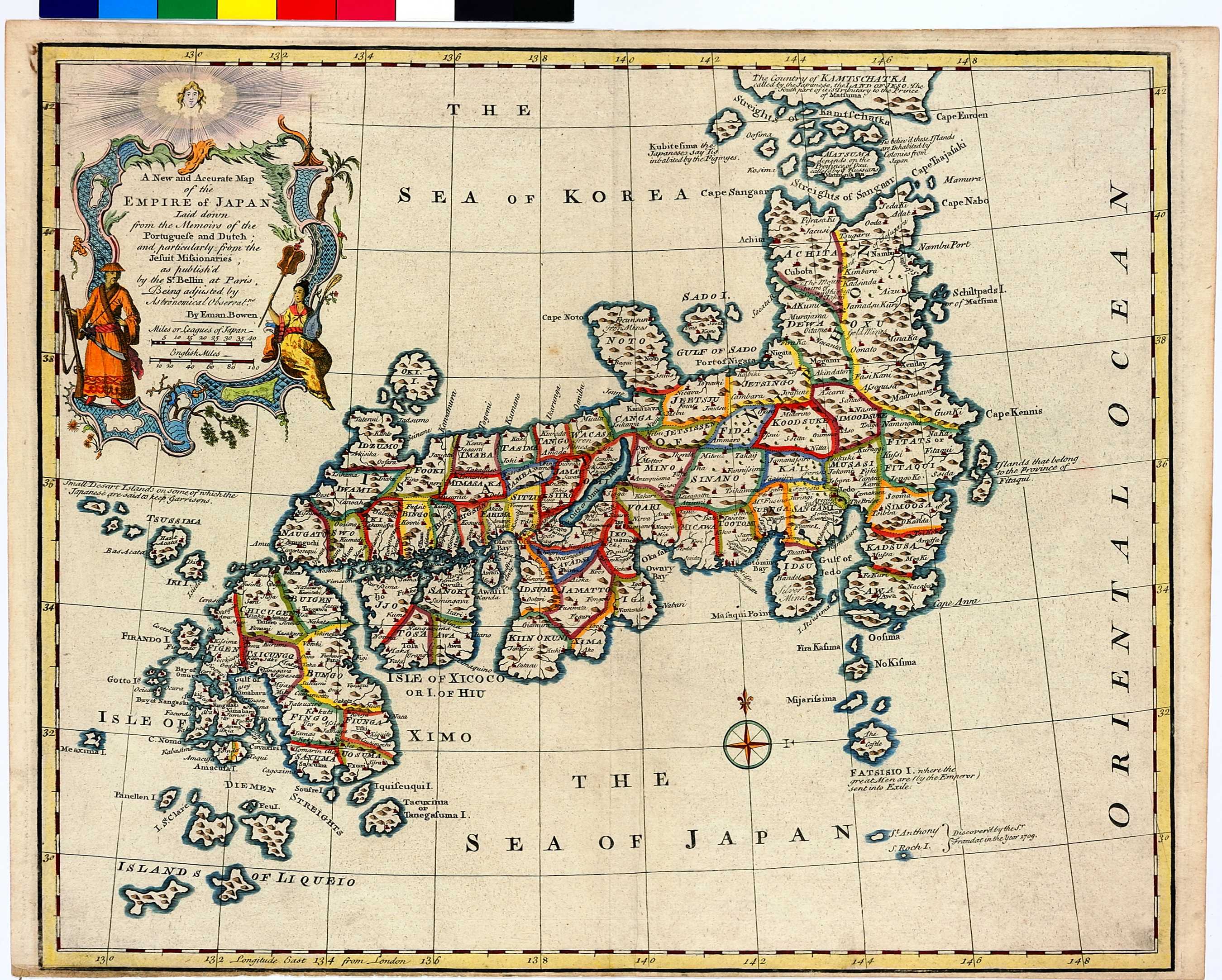
| 資料名(日): A New and Accurate Map of the EMPIRE of JAPAN. |
| 資料名(英): A New and Accurate Map of the EMPIRE of JAPAN. |
| 画像頁G: |
| 所蔵: 成立・出版年(西暦): 1744 成立・出版年(和暦): 出版地(日): ロンドン |
| 出版者(日): |
| 出版者(英): |
| 作成者(日): |
| 作成者(英): Bowen, Emanuel |
| アトラス・書名: A Complete System of Geography, 2 vols. (In vol II.) London, 1744 |
| 版画家(日): メディア(日): 銅版画 |
| 地図サイズ: 35.5×43.0 cm メディア(英): - エリア(日): 日本、蝦夷、琉球 |
| 出版特権: |
| 地図備考(日): |
| 地図備考(英): A variant has "No. 80" erased, and "No. 42" engraved underneath the lower left corner. The map also appears in one or other of its states in vol. 2 of the 1747 edition of the Complete System, and in A Complete Atlas or Distinct View of the Known World, London, 1752. |
| 地図解説(日): |
| 地図注釈(日): |
|
参考文献(英):
Campbell: 61; Cortazzi: pl. 81; OAG: 92 > List of References |
|
追加の参考文献(日):
> List of References |
| 地図の位置: BL Shelfmark: C.39.e.7. |
|
所蔵資料の利用に関しましては所蔵資料ご利用ガイドをご覧ください。 |