| 詳細情報表示 | 1件の内1件目を表示中 |
| 新規検索 |
| サムネイル一覧 | 簡易情報付一覧 | ArtWiki |
| No. BLMAP-0108 Nickname. |
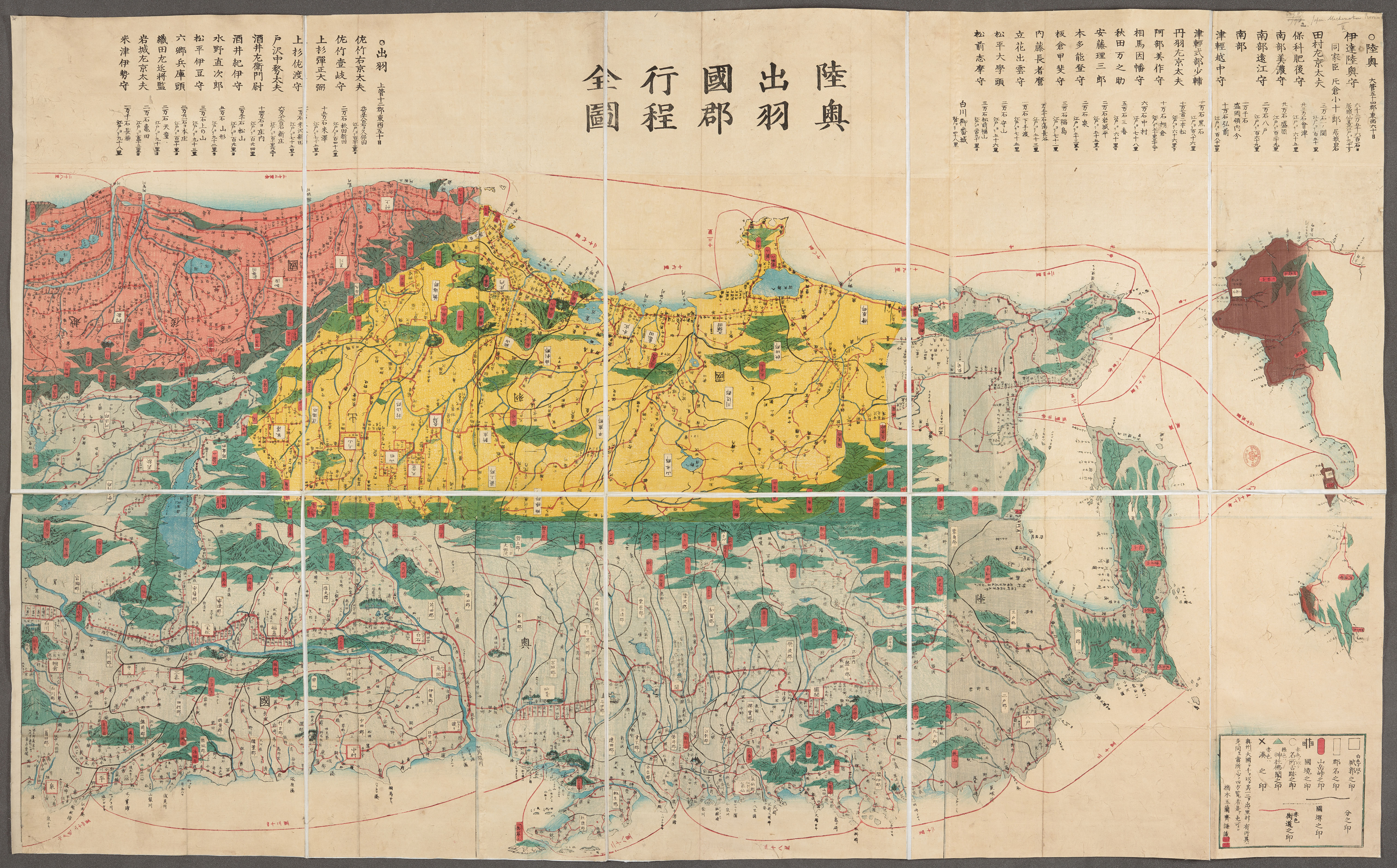
| 資料名(日): 陸奥出羽国郡行程全図 |
| 資料名(英): Mutsu dewa kokugun kotei zenzu [Complete map of the provinces, districts and routes of Mutsu and Dewa] |
| 画像頁G: |
| 所蔵: 大英図書館 British Library 成立・出版年(西暦): 成立・出版年(和暦): 幕末刊 出版地(日): |
| 出版者(日): |
| 出版者(英): |
| 作成者(日): 橋本玉蘭斎画 |
| 作成者(英): 橋本玉蘭斎画 / Hashimoto Gyokuransai (1807-1873) |
| アトラス・書名: |
| 版画家(日): メディア(日): |
| 地図サイズ: 73x144 メディア(英): エリア(日): |
| 出版特権: |
| 地図備考(日): *無刊記。多色刷り。外題「(陸奥出羽)国郡行程全図(付越後半国)」。 |
| 地図備考(英): |
| 地図解説(日): |
| 地図注釈(日): |
|
参考文献(英):
> List of References |
|
追加の参考文献(日):
> List of References |
| 地図の位置: 大英図書館 British Library Shelfmark: Maps 62987(2) |
|
所蔵資料の利用に関しましては所蔵資料ご利用ガイドをご覧ください。 |
![]()