|
|
No.
cortazzi008
Nickname.
|
|
資料名(日):
ROYAUME DU IAPON
|
|
資料名(英):
ROYAUME DU IAPON
|
|
画像頁G:
|
|
所蔵:
成立・出版年(西暦):
1658c
成立・出版年(和暦):
出版地(日):
パリ
|
|
出版者(日):
|
|
出版者(英):
Mariette, Pierre
|
|
作成者(日):
|
|
作成者(英):
Briet, Philippe
|
|
アトラス・書名:
Cartes Generales de toutes les parties du monde . . . par le Sieur Sanson d'Abbeville . . . L'Auteur . . . Pierre Mariette, Paris, 1658* (See: Map Comments)
|
|
版画家(日):
メディア(日):
銅版画
|
|
地図サイズ:
37.0×52.0 cm
メディア(英):
-
エリア(日):
日本、朝鮮、蝦夷
|
|
出版特権:
|
|
地図備考(日):
|
|
地図備考(英):
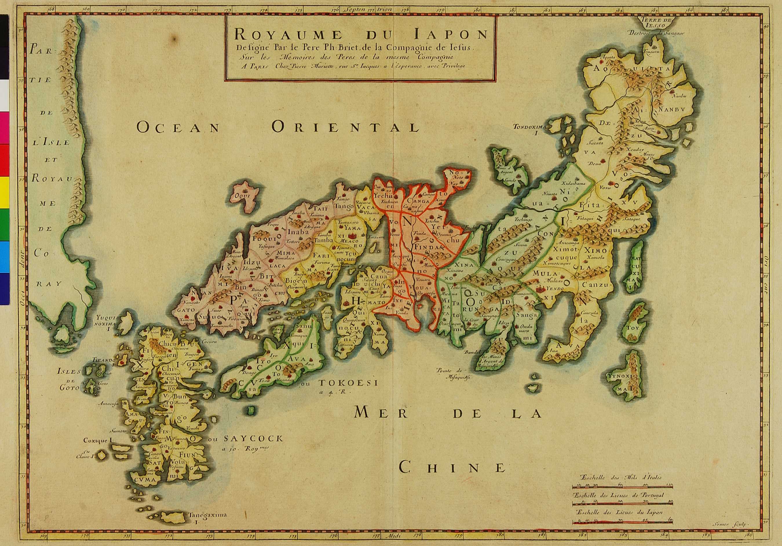
(Walter:) A second state of the plate adds the designations "Iamaysoit", "Ietsen", "Ietsegen", "Quanto", and "Ochior" on the main island. "ou TOKOESI a 4.R." is added to Shikoku, and "ou SAYCOCK a jo. Roy.mes" to Kyushu. West of the Izu Peninsula "Pointe de Misaquiasi" is changed to "Pointe de MisaquiAsi" and "Bandel" is added. Northeast of Kyushu "Tocura" is corrected to "Cocura". This later state appears in Cartes Generales de la Geographie ancienne et nouvelle . . . par les S.rs Sanson . . . Chez L'Auteur, et chez Pierre Mariette, Paris, 1676. // Briet is known to have published Atlases in 1648, 1649 and 1653, but none of the listings mention a map of Japan. The 1653 Atlas was published by Pierre Mariette, and as he was a partner of N.Sanson. The map appeared in several editions of the Sanson Atlas, e.g. in Cartes Generales de toutes les parties du monde. . .par le Sieur Sanson d'Abbeville. . .Paris, Pierre Mariette 1658 [1663].
|
|
地図解説(日):
|
|
地図注釈(日):
|
参考文献(英):
AEN 275, v.1, [18]; Campbell: 17, pl. VIII; Cortazzi: pl. 67; Pastoureau: p.89
> List of References
|
追加の参考文献(日):
> List of References
|
|
|
|
地図の位置:
BN
Shelfmark:
GeDD 2641 (vol. II) (State 2)
|
|
|
|
|
|
所蔵資料の利用に関しましては所蔵資料ご利用ガイドをご覧ください。
If you wish to use any of the images from our databases for purposes other than personal use, please click here.
|
|