| 詳細情報表示 | 5832件の内290件目を表示中 |
| ← 前の作品 | 新規検索 | 次の作品→ |
| サムネイル一覧 | 簡易情報付一覧 | ArtWiki |
| No. BLMAP-0018 Nickname. |
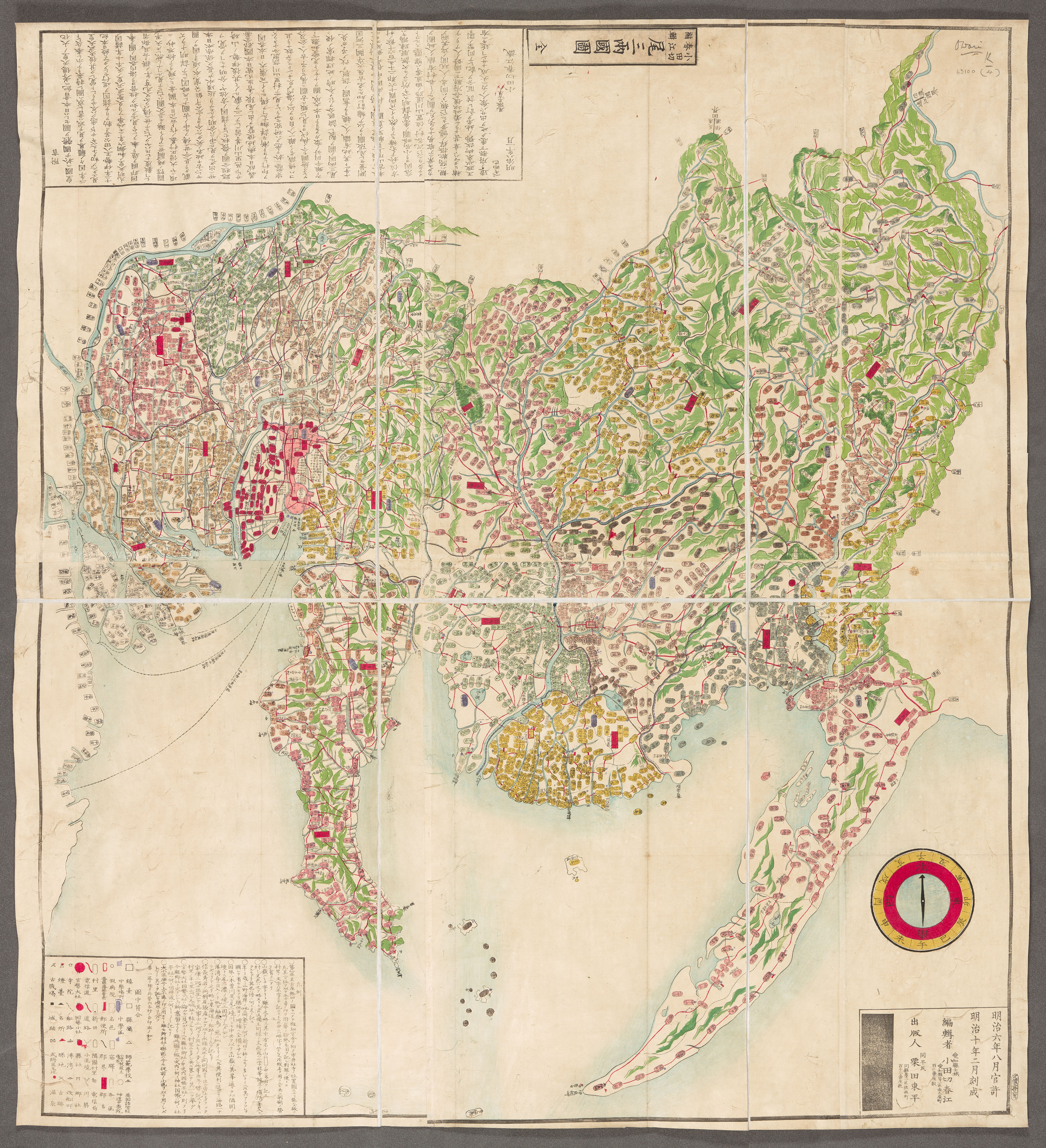
| 資料名(日): 尾二両国図 |
| 資料名(英): Bisan ryogoku zu [Map of the provinces of Owari and Mikawa] |
| 画像頁G: |
| 所蔵: 大英図書館 British Library 成立・出版年(西暦): 1877 成立・出版年(和暦): 明治10 出版地(日): 愛知県 |
| 出版者(日): 栗田東平 |
| 出版者(英): 栗田東平 |
| 作成者(日): 小田切春江著 |
| 作成者(英): 小田切春江著 / Odagiri Shunko (1810-1888) |
| アトラス・書名: |
| 版画家(日): メディア(日): |
| 地図サイズ: 94x84 メディア(英): エリア(日): |
| 出版特権: |
| 地図備考(日): *多色刷り。刊記に「明治六年八月官許/明治十年二月刻成」とあり。 |
| 地図備考(英): |
| 地図解説(日): |
| 地図注釈(日): |
|
参考文献(英):
> List of References |
|
追加の参考文献(日):
> List of References |
| 地図の位置: 大英図書館 British Library Shelfmark: Maps 63100.(4) |
|
所蔵資料の利用に関しましては所蔵資料ご利用ガイドをご覧ください。 |
![]()