|
|
No.
cortazzi024
Nickname.
|
|
資料名(日):
PLAN DU PORT ET DE LA VILLE DE NAGASAKI
|
|
資料名(英):
PLAN DU PORT ET DE LA VILLE DE NAGASAKI
|
|
画像頁G:
|
|
所蔵:
成立・出版年(西暦):
1763
成立・出版年(和暦):
出版地(日):
パリ
|
|
出版者(日):
|
|
出版者(英):
|
|
作成者(日):
|
|
作成者(英):
Bellin, Jacques-Nicolas
|
|
アトラス・書名:
Petit Atlas Francois, 5 vols., Paris, 1763 [in Vol. 3] Also in: Le Petit Atlas Maritime, 5 vols., Paris, 1764 [in vol. 3]
|
|
版画家(日):
メディア(日):
銅版画
|
|
地図サイズ:
19.5×33.0 cm
メディア(英):
-
エリア(日):
長崎
|
|
出版特権:
|
|
地図備考(日):
|
|
地図備考(英):
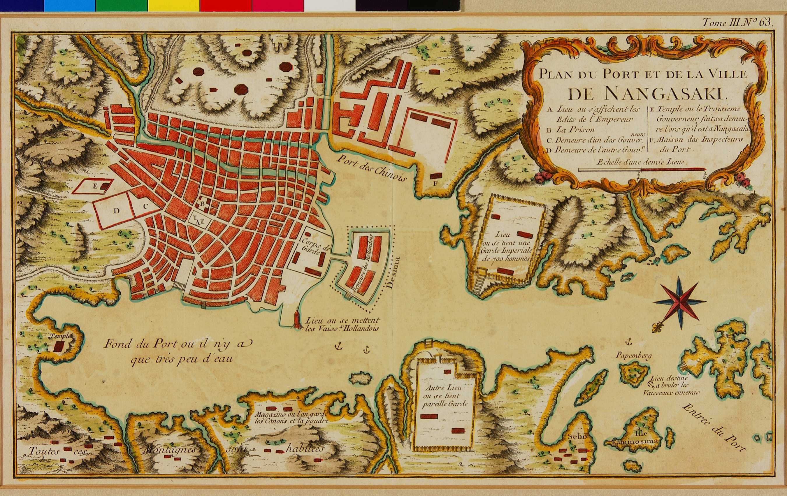
(Walter:) Bellin used his map of Nagasaki (cat. no. 100), as well as the other maps he prepared for Charlevoix’s book, both for Prevost’s collection of travel- descriptions and for the atlas editions that were sold in coloured versions. In so doing, he simplified the map even more and also schematized the remaining buildings.
|
|
地図解説(日):
|
|
地図注釈(日):
|
参考文献(英):
Campbell: 71, pl. XXVI; Cortazzi: pl. 51
> List of References
|
追加の参考文献(日):
> List of References
|
|
|
|
地図の位置:
NMM
Shelfmark:
Catalogue: 211 (Le Petit Atlas Maritime)
|
|
|
|
|
|
所蔵資料の利用に関しましては所蔵資料ご利用ガイドをご覧ください。
If you wish to use any of the images from our databases for purposes other than personal use, please click here.
|
|