| 詳細情報表示 | 5832件の内17件目を表示中 |
| ← 前の作品 | 新規検索 | 次の作品→ |
| サムネイル一覧 | 簡易情報付一覧 | ArtWiki |
| No. cortazzi018 Nickname. |
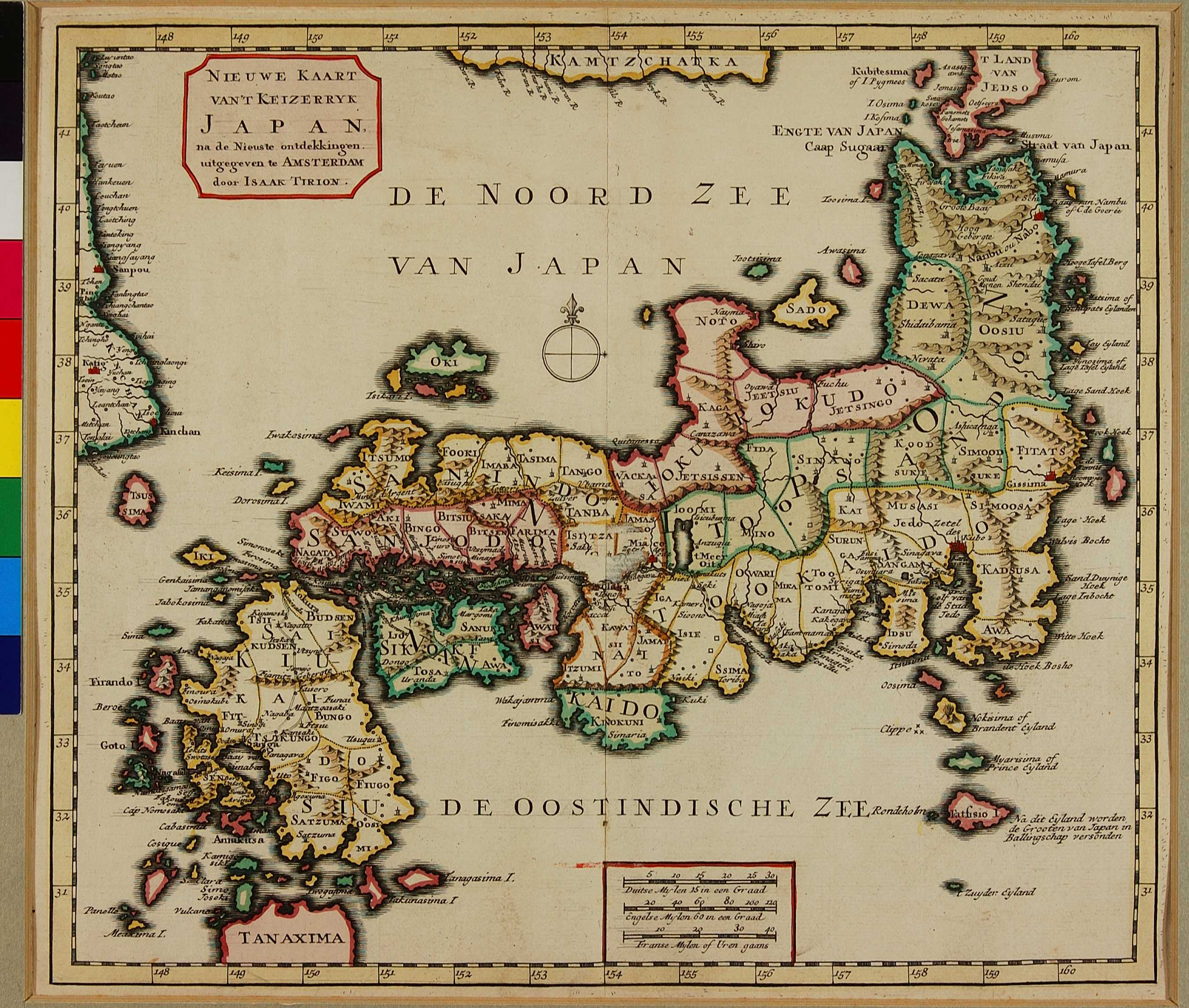
| 資料名(日): NIEUWE KAART VAN'T KEIZERRYK JAPAN. |
| 資料名(英): NIEUWE KAART VAN'T KEIZERRYK JAPAN. |
| 画像頁G: |
| 所蔵: 成立・出版年(西暦): 1740c 成立・出版年(和暦): 出版地(日): アムステルダム |
| 出版者(日): |
| 出版者(英): |
| 作成者(日): |
| 作成者(英): Tirion, Isaac |
| アトラス・書名: Nieuwe en Beknopte Hand-Atlas . . . By Isaak Tirion . . ., Amsterdam, 1744 [ca. 1740] |
| 版画家(日): メディア(日): 銅版画 |
| 地図サイズ: 27.5×31.5 cm メディア(英): - エリア(日): 日本、朝鮮、蝦夷 |
| 出版特権: |
| 地図備考(日): |
| 地図備考(英): (Walter:) An enlarged copy of OAG 77 with changes made to northern Honshu and to southern Hokkaido. Despite the title page of this atlas being dated 1744, it contains maps with dates from 1730 onwards, while the present map is undated. |
| 地図解説(日): |
| 地図注釈(日): |
|
参考文献(英):
Campbell: 54; Cortazzi: pl. 80; OAG: 91 > List of References |
|
追加の参考文献(日):
> List of References |
| 地図の位置: BL Shelfmark: Maps C.39.e.10 |
|
所蔵資料の利用に関しましては所蔵資料ご利用ガイドをご覧ください。 |