|
|
No.
cortazzi024
Nickname.
|
|
資料名(日):
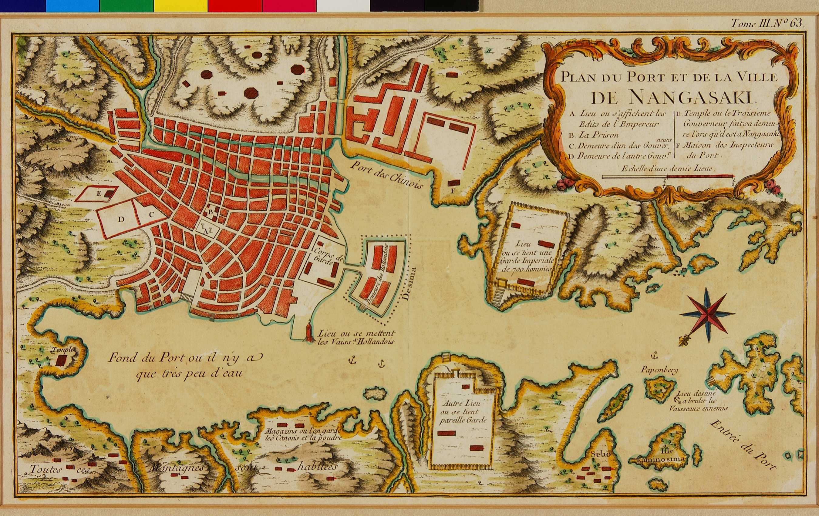
PLAN DU PORT ET DE LA VILLE DE NAGASAKI
|
|
資料名(英):
PLAN DU PORT ET DE LA VILLE DE NAGASAKI
|
|
画像頁G:
|
|
所蔵:
成立・出版年(西暦):
1763
成立・出版年(和暦):
出版地(日):
パリ
|
|
出版者(日):
|
|
出版者(英):
|
|
作成者(日):
|
|
作成者(英):
Bellin, Jacques-Nicolas
|
|
アトラス・書名:
Petit Atlas Francois, 5 vols., Paris, 1763 [in Vol. 3] Also in: Le Petit Atlas Maritime, 5 vols., Paris, 1764 [in vol. 3]
|
|
版画家(日):
メディア(日):
銅版画
|
|
地図サイズ:
19.5×33.0 cm
メディア(英):
-
エリア(日):
長崎
|
|
出版特権:
|
|
地図備考(日):
|
|
地図備考(英):
(Walter:) Bellin used his map of Nagasaki (cat. no. 100), as well as the other maps he prepared for Charlevoix’s book, both for Prevost’s collection of travel- descriptions and for the atlas editions that were sold in coloured versions. In so doing, he simplified the map even more and also schematized the remaining buildings.
|
|
地図解説(日):
|
|
地図注釈(日):
|
参考文献(英):
Campbell: 71, pl. XXVI; Cortazzi: pl. 51
> List of References
|
追加の参考文献(日):
> List of References
|
|
|
|
地図の位置:
NMM
Shelfmark:
Catalogue: 211 (Le Petit Atlas Maritime)
|
|
|
|
|
|