|
|
No.
cortazzi021
Nickname.
|
|
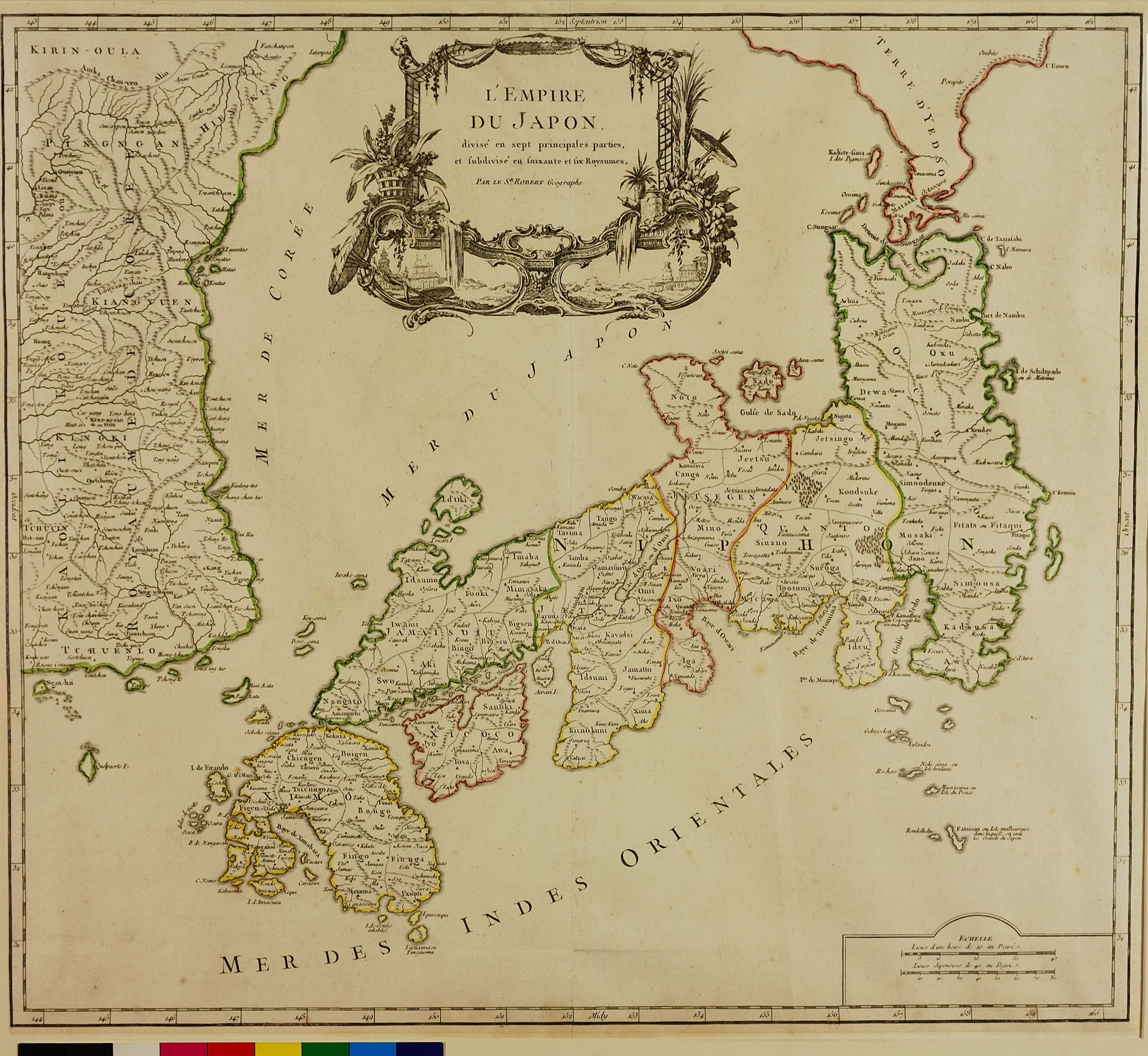
資料名:
L'EMPIRE DU JAPON
|
|
Title:
L'EMPIRE DU JAPON
|
|
画像頁G:
|
|
所蔵:
成立・出版年(西暦):
1750
成立・出版年(和暦):
Place:
パリ
|
|
出版者:
-
|
|
Publisher:
-
|
|
作成者:
-
|
|
Cartographer:
-
|
|
Atlas / Book Title:
Atlas Universel, Par M. Robert . . . Et Par M. Robert de Vaugondy son fils . . . Chez les Auteurs . . . Boudet Librairie Imprimeur du Roy . . ., Paris, 1757
|
|
Engraver:
-
Medium:
銅版画
|
|
Map Size:
48.5×53.5 cm
Medium:
c:1:15,800,000
Area:
日本、朝鮮、蝦夷
|
|
Privilege:
-
|
|
地図備考:
|
|
Map Notes:
Although the atlas was completed in 1757, some maps were published as early as 1752 to canvass subscriptions, or to supply subscribers. The first state does not include the frame around the mileage scale and there are number of town names omitted. A second state added the frame and corrected a number of place names. A third state, with the date erased from the cartouche, was issued several times after 1786 by Charles Francois Delamarche, who acquired Didier Robert de Vaugondy's business from his successor, Jean Baptiste Fortin. For a reengraved version see OAG 115. Note that Gilles published under the name of Robert, his mother's maiden name, whereas his son Didier added to this Vaugondy, his grandfather's name.
|
|
Map Discription:
|
|
Map Comments:
|
Japan Reference:
Campbell: 65, pl. XXIV; OAG: 100
> List of References
|
Additional Reference:
See: Entry 410 in: Bel et UtileThe Work of the Robert de Vaugondy Family of Mapmakers by Mary Sponberg Pedley, Map Collector Publications, Tring, Herts., 1992
> List of References
|
|
|
|
Map Location:
BL
Shelfmark:
Maps 38.f.4
|
|
|
|
|
|